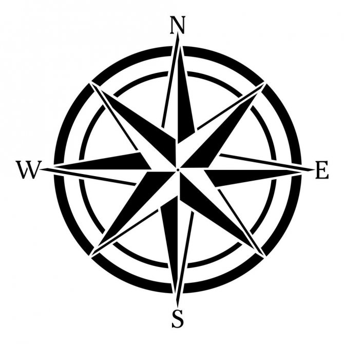
Where the compass needle points: features and interesting facts
- July 26, 2018
- Tips for tourists
- ROME.
The simplest and oldest navigation device is the compass. It allows you to navigate the terrain: its magnetic needle always points north. This device has ancient origins and many interesting stories are associated with it. The compass needle pointing north allows you to find the path, and they were looking for it using the compass long before the birth of Christ.
What does the Chinese have to do with it?
Many of the inventions we use were invented by the Chinese, and the compass is no exception. There are different reports about the appearance of compasses. According to some, they were invented 3 thousand years BC, while others claim that compasses appeared around 200 BC. The first assumption is based more on myths than facts.
The first compass was invented in China during the reign of Emperor Huang Di. He helped him find his way in the desert and saved his army from death. However, there are no historical facts about this case.
According to another version, compass needles began to be used during the Han Dynasty. The ancient device was a magnetized object. The compass needle always pointed in the same direction.
There is reliable information about the Sun Dynasty. Facts show that in the twentieth century AD, the Chinese navigated by compass and determined the cardinal directions.
From China around the world
From China the compass came to the Arabs. They were considered good sailors, but even they needed navigation devices. The compass arrow always points in the same direction, therefore, it is easy to navigate using such a device. The Arabs liked the idea of a compass, however, in those days they used water and a magnetized metal object, which was lowered into a container, as a guide. He turned in the same direction. In this form, the ancient compass came to European countries, where a compass was vitally needed, and they quickly figured out how to improve the Arab device.
After some thought, F. Gioia came up with a device that allows one to more accurately navigate to the cardinal points. And in order to narrow the landmarks, making them as accurate as possible, the compass dial was divided into 16 divisions. The compass needle was mounted on a pin, and water was poured into the bowl to reduce friction in the axis. Since then, devices have changed a lot. But the developer’s very idea is still used in modern compasses.
Types of compasses
Different types of devices are used for different areas. And here the question arises: if they are different, then where does the compass point, and which is the most accurate?
In the modern world, the following types of compasses are used:
- Magnetic. This variety works on the action of the Earth's magnetic field. The magnetized elements occupy a position parallel to the meridians and point towards the magnetic poles of the planet. And there are two of them - northern and southern. One of the best magnetic compasses was invented by Andrianov. This is a well-known compass with an arrow that can be slowed down using a stopper. To navigate using Andrianov's compass, a scale has been developed. And there are two additional arrows.
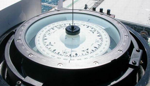
- An electromagnetic compass operating on the principle of electromagnetic induction. The fixed part of such devices is the Earth, and the moving part is the frame with the winding. Similar compasses are used on ships and airplanes, since they are not magnetized.
- Gyro-compass. This is the same device that is used to determine the poles, but where does the needle of this type of compass actually point? The devices show the direction of the geographic poles, not the magnetic ones. This compass was invented by a German engineer in the twentieth century.
- Electronic devices. In fact, these are not even compasses, but electronic devices that receive a signal from a satellite and show the direction of the cardinal points.
Why doesn't the needle point to true north?
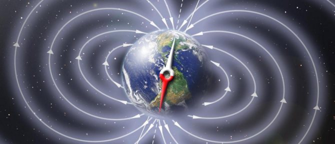
As already mentioned, the needle of a magnetic compass shows the direction to the magnetic north and south of the Earth. However, the location of the magnetic poles does not coincide with the location of the Earth's true poles. In addition, the position of the Earth's magnetic poles is constantly changing, and the rate of change is not constant over time and differs at the north and south magnetic poles, which is associated with processes occurring in the bowels of the planet.
Thus, the statement that the magnetic compass needle always points to true north is erroneous.
We have often heard that in Alaska, the largest state in the United States, the magnetic compass needle points not to the north, but to the east. This is not entirely true. If we look at the map of the magnetic declination isogons, we can see that the greatest deviation of the arrow to the east will not even reach 40°, and this is not the eastern direction, but the northeastern one. But if we talk about where the compass needle points to the west instead of north, then there is such a territory - this is Nunavut, which recently became part of Canada.
The isogon map is shown below:
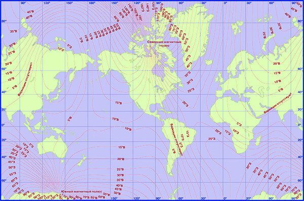
However, if necessary, it is still possible to determine the direction to the true poles of the Earth using the readings of a magnetic compass. To do this, you need to know the magnitude of the magnetic declination, which we talked about in a separate article...
Changing direction
It would seem that a compass is a device that is unable to deceive, but this is not so. Every device can fail, and a compass is no exception. Therefore, in order to accurately determine the compass readings, where the red arrow of the device is pointing, and whether it is in the right direction, it is worth excluding the following:
- Are there any third-party magnets nearby? If other magnets are located nearby, the compass needle will deviate and show the wrong direction.
- Location of an electronic device nearby. Even the simplest smartphone creates an electromagnetic field around itself, which creates interference, causing compass needles to deviate in the wrong direction.
- The accuracy of the indicators is affected by magnetic storms and solar wind.
- Interference is created in anomalous areas. There are several similar zones on our planet where strange things happen. For example, the Kursk magnetic anomaly, where compasses “go crazy.”
The navigation device does not always display correctly; in some cases it produces errors. They can be caused by ore deposits, and not only.
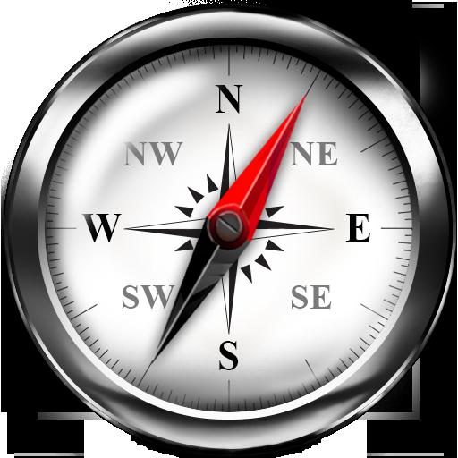
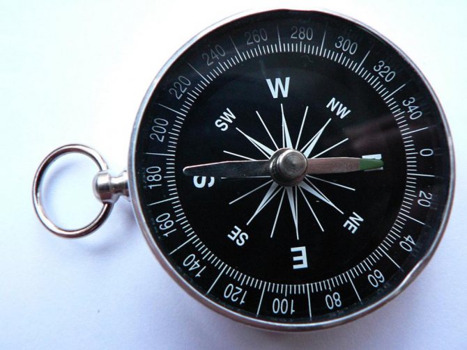
Arrow direction
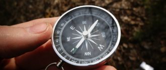
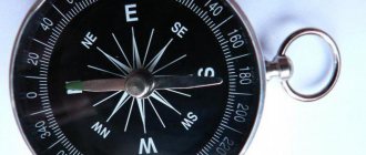
A compass usually has one arrow divided into two parts, or two arrows directed in opposite directions. In the classic version they are painted blue and red. The blue arrow or the one with a triangle at the tip always points to the north, and the red or wide shapeless one always points to the south. Sometimes devices are equipped with arrows of other colors. For example, green. When using such devices, the question arises: where does the green compass arrow point? Typically, a red or pink arrow always points to the south, and other shades are indicators of the north direction. Now you know where the green compass needle points. On North.
In addition to green, the north arrow can be painted white, yellow, silver, and also black. Other arrow designs are possible. They can be painted the same color, but have different shapes. In all models of compasses, the arrow indicating the north direction is always marked. These can be marks of different shades, or there can be different shapes of arrows in the form of a triangle. In older models, the southern tip is marked in red, but in newer ones it can be anything, and the red arrow can point to the north. This is worth considering before you start using the device.
First compass
It looked like a ladle with a handle located on a copper plate; to find out the cardinal directions, you had to rotate the ladle, and at the moment it stopped, the handle pointed to the south. This miracle was invented in Ancient China. And the ladle was not chosen by chance. After all, it was copied from the “Heavenly Bucket.” This is what the Chinese called the constellation Ursa Major. But then people did not yet know why the compass needle always points north. Several centuries passed, and in 1600 Gilbert William, an English physicist and explorer, wrote a book about magnets, magnetic bodies and the big magnet - the Earth. It is he who takes the lead in providing a reasoned explanation of why the compass needle always points north.
Where does the red arrow on the compass point?
Think you know the answer? Let's check: the compass needle is aligned with the Earth's magnetic field lines. They are connected to the true meridians by a simple function, which can be calculated by any tourist who puts a mat guide under his head. analysis. From a practical point of view, this means that the arrow points to the magnetic pole only in exceptional cases, and for the most part it points to nowhere. For many, this is a revelation, but if you, %username%, conducted an experiment at school with metal shavings scattering around a magnet, then you probably understand what we are talking about. However, you can check the difference between the magnetic declination and azimuth to the magnetic pole yourself: today ( ) the north pole lives at 86.4° latitude and 135.124° longitude. A magnetic declination calculator is available on the website.
Now that the intrigue is over, we can move on to the really important questions: how to use a compass, how we got to such a difficult life and, of course.
Who dynamized the dinosaurs
At the beginning of the last century, Albert Einstein expressed open distrust of the dynamo theory, according to which the Earth’s magnetic field is formed due to the banal cooling of the planet. Today this is the main version that is commonly discussed in polite society:
- the liquid part of the planet's core contains a lot of iron and is a good conductor at high temperatures;
- cooling of the planet leads to the appearance of convection currents;
- inertial forces twist convection flows into spirals, which leads to friction of cooling flows against each other;
- friction leads to the appearance of loop currents and a weak magnetic field;
- If everything goes well, then the movement of conductors in a magnetic field leads to self-excitation of currents and strengthening of the field.
It is easy to see that the system is extremely unstable, and if we remember about the unstable solar radiation, then we become alarmed about the future of the planet. And for good reason: look at Mars, whose magnetic field is 500 times weaker than the Earth’s. The core of Mars rotates weakly relative to the outer layers, which is why the dynamo effect does not work on it, the solar wind blows across the planet, and the radiation on the surface is such that in one day the rover receives a radiation dose corresponding to the annual norm of a resident of Greece. Yes, the magnetic field not only indicates the direction, but also protects us from the yoke of cosmic radiation.
Over the scale of eons, the planetary dynamo behaves chaotically: the strength of the magnetic field and the distribution of field lines change, and pole reversals are a common phenomenon that can occur randomly. When the magnetic field is inverted, the poles change places, a terrible chaos occurs, the compass needle points only to the foggy future, and the magnetosphere weakens hundreds of times. According to one version, the Cretaceous-Cenozoic extinction is associated with just such an unpleasant incident, but, fortunately for Homo Sapiens, the last inversion occurred approximately 720 thousand years ago and does not threaten us in the near future. However.
The North Pole is coming to Russia
It is impossible to say with certainty where the North Pole is moving, but at the beginning of this century it left the shores of Canada, where it had wandered for almost a century, and set off on a long journey through the Arctic. Calculations show that with such a temperament, he will end up in Siberia in the next 30 years. Why is he moving so fast? A magnetic pole is an area on the surface of a planet in which the field lines go underground, i.e. The compass points straight down towards the magnet itself. In addition to the magnetic pole, there is also a geomagnetic pole - the theoretical point at which the axis of a planetary magnet intersects the surface of the planet. The geomagnetic pole is relatively stable and will begin to move only when the field is inverted; the magnetic pole depends on the magnetic moment (field strength) and a bunch of different factors, including solar radiation, tidal forces and simply unstudied influences. Therefore, the assumption about his visit to Russia cannot be called strictly scientific.
Even its probable inventors, the Chinese masters of the Han dynasty (first century AD), knew about the difference between the geographic and magnetic poles, but the scientific community became concerned with the movement of the poles only in the middle of the last century, when regular measurements began to be taken. The result of this concern was the creation of the International Analytical Field - a mathematical model updated every five years according to data from institutions around the world. The fact is that technically the movement of the pole is not so easy to notice, and accurate calculations require a large amount of measurements. It wasn't easy to accumulate it. Medieval sailors knew how to use a compass, a clock and the North Star. The direction towards it coincides with the axis of rotation of the earth, i.e. it points to the geographic north, its height above the horizon is the latitude of the area. The difference between the direction of the North Star and the compass readings is quite obvious, and sailors had an excellent opportunity to measure this difference in different parts of the world. In 1701, Edmond Halley completed many years of exploration of the Atlantic and made the first map of magnetic declination (compass deviation in horizontal projection), which allowed England to strengthen maritime hegemony. Such maps began to be issued regularly until, by the 20th century, they became periodicals.
Today there is no need for direct observations: the International Magnetic Model (WMM) allows the pole position to be calculated using relative measurements. Based on the WMM, the movement of the pole is also modeled, which precisely shows its desire to move to the shores of Russia. From a practical point of view, this means that when orienting by compass, the freshness of data on magnetic declination is of great importance: over the year it changes by 0.3-0.7°.
How to navigate the terrain on the Moon?
For orientation on the Moon, it is hypothetically possible to use some compasses, the operation of which does not depend on the magnetic field.
These include, in particular:
- Satellite compass. Its operation is based on sending and receiving signals from satellites that must be in orbit around the Moon. And if you have such satellites, you can also improve the operation of the navigator.
- Gyro-compass. Its work is based on the work of the gyroscope and partly on the gravity of the planet. We discussed this navigation device in detail in a separate article (Gyrocompass).
- Radio compass. For this purpose, it is necessary to place radio transmitters on the Moon, based on the signal from which orientation occurs. Moreover, there should be a lot of radio transmitters, because due to the lack of an atmosphere reflecting short radio waves, and the significant curvature of the Moon due to its small size compared to the Earth, such radio signals may simply not reach the “consumer”. In general, this issue has not yet been fully studied by science and, perhaps, in the future more effective instruments for orienting on the Moon will appear.
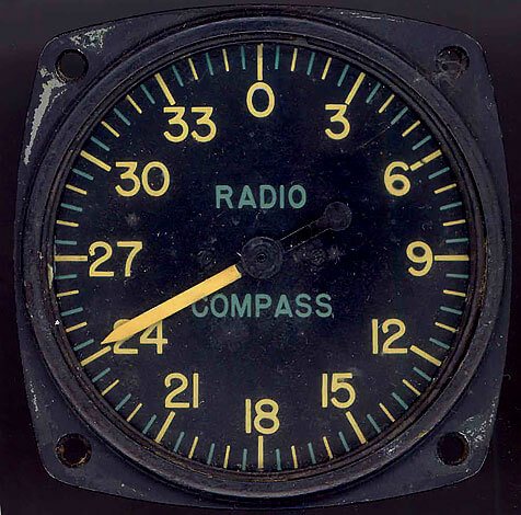
Since there are no radio stations on the Moon today, you can’t count on a radio compass working on it.
Knowledge of astronomy will also help you navigate the Moon. To do this, it will be enough to look at the sky and find the Earth, the Sun or other stars.
Unfortunately, for the conditions of the Moon, there are no clearly visible polar stars by which one could accurately navigate. Therefore, as in the southern hemisphere of the Earth, here you have to get out and use what you have.
How to use a compass
The start and finish points on the map are connected by the line of the shortest route. To find it in reality, you need to get directions to the finish from the starting point. How can we do this if the only quantity we know is the compass reading? That's right, set an angle from the direction of the compass arrow and stick to it as you move. This angle (with some reservations) is called azimuth and is measured from the direction of the magnetic needle in degrees (or in points, if desired) clockwise. Those. conditional North is 0°, West is 270°. You can find the azimuth in several ways:
- Take azimuth directly on the ground;
- Plot the azimuth on the map, adding the magnetic declination to it.
The first method is well suited for rough terrain, when the second hill is visible from the first hill of the route, and the third from the second, etc. Using a compass in such cases is relatively simple: you need to stand on a hill, align the compass needle with 0° and visually determine with the help of a compass protractor the degree pointing to the next point on the path. In a good compass, a sighting lens is made for this purpose, through which you need to look at the final object. The second method of compass orientation is used when the standing point is known and can be marked on the map. The compass is placed on the map so that the center is at the standing point (observer's position), 0° corresponds to the geographic north (meridian, line of longitude). In this case, the compass protractor is used as a regular protractor, which can be supplemented with a ruler or any flat object. The map gives the true azimuth, so the magnetic declination of the area is added to it (if the declination is eastern) or subtracted (if the declination is western).
In order not to constantly search for azimuth with your eyes, the compass allows you to set it once. To do this, the center line of the compass or other sighting device is aligned with the desired azimuth by rotating the protractor, and while moving, the compass is held so that the compass needle is aligned with 0°. However, before you start using the compass in the forest, you should test the device in the city. Most compasses are compact in size, and the needle on them swings strongly when moving (the exception is compasses made of rare-earth magnets, such as Moskompass, or compasses with a lock), so you should be extremely picky about their readings while moving. To reduce the error, the compass is not used constantly, but with its help, they find landmarks within sight and move towards them in order to repeat the measurements and move to the next point. The further away the reference point, the less the influence of errors. What can serve as a guide? A fallen tree, a rock, an eagle flying in the sky. In short, any stationary object.
How to use a compass if you have to move in a dense forest? Practice shows that the azimuth always points to the snout and windbreak, so that movement strictly in azimuth is inevitably associated with a slowdown in movement. A map comes to the rescue: in difficult terrain, it is necessary to constantly compare visual observations with cartographic data and note the deviation from the original azimuth. In addition, using a map, you can take intermediate azimuths to go around a swamp or other local obstacle, provided that all turning points can be fixed on the map when determining the distance in steps.
Find yourself on the map
Using a compass, you can determine your position through the intersection of azimuths, if there are landmarks indicated on the map within visibility. For each of them, the azimuth is taken, the magnetic declination is subtracted (!) from it, reverse azimuths (-180°) are marked on the map from the landmarks, and the intersection point is found. In this case, you need to use a compass with great caution: the error for sharp corners is large. The same principle is used when finding a standing point on a linear object (power line, road, forest belt, edge of a clearing): only one azimuth is needed, which will intersect the object line on the map.
When using a compass for distances greater than the conventional 100 km, the curvature of the Earth comes into play. This amendment is not significant for tourists, but is of great importance for navigation. Small-scale maps use the Mercator scan to reduce the curved shape of the planet to a flat map rectangle. The Mercator map correctly preserves the angles to the meridians, but the azimuth taken from such a map does not correspond to the direction of the shortest movement. Strictly speaking, the azimuth when moving along the shortest route on a sphere changes continuously (if you are not moving along the equator), which is easy to see through the Vincenty formula (through which the azimuth is calculated using two coordinates) or its simplified version - the haversine formula. Within the limits of hiking trips, this deviation, fortunately, rarely goes beyond a degree, even for the full route. So the compass can be used to navigate any terrain, which is undoubtedly more pleasant than trusting GPS or, even worse, a smartphone.
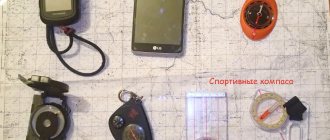
Types of tourist compasses
To begin with, let's figure out what types of tourist compasses there are.
First of all, let’s remember the old and well-known Adrianov compass . By the way, Adrianov is a Russian military cartographer who, in fact, designed an illuminated compass (phosphorus-based) back in 1907.
The advantages of this instrument are that the arrow indicator, the cardinal direction, and the front sight indicator are illuminated in the dark. In addition, it is quite reliable and is very popular among tourists in post-Soviet countries. The downside to using it is that the magnetic needle is unstable when moving.
There is also an opinion that some compasses of this type are radioactive. This applies to old compasses that used radioactive elements for illumination.
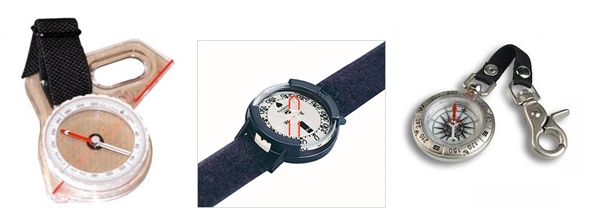
In orienteering (we hold similar events as part of one- and two-day hikes, follow the link so as not to miss) liquid compasses . Due to the fact that its internal volume is filled with liquid (kerosene, etc.), the arrow does not fluctuate when walking or running. This is quite convenient when you need to quickly navigate and reach objects.
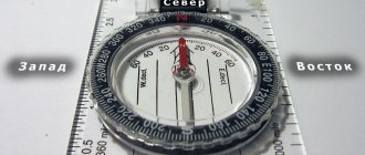
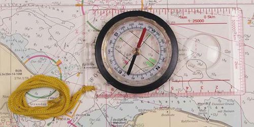
Tablet compasses are also popular among tourists . They are convenient because they have a ruler with a pointer and a magnifying glass. This helps you navigate the map more accurately.
In addition, you can select a keychain compass, wrist compasses, and a finger compass.
But the most important thing when choosing this item, in addition to its visual appeal and ease of use, is to make sure of its functional suitability and serviceability.
Since the market is oversaturated with goods from China, it is necessary to check the compass as follows before purchasing. First, we check whether the direction of the magnetic needle corresponds to geographic north. If everything is in order with this, we bring a metal object, for example, a knife, to the compass. The arrow should deviate from its original position. Then we take the item. After this, the arrow should return to its original position without visible deviations.
All tourist compasses use the property of a magnetized needle to be located along the magnetic lines of force of the Earth. At the same time, for ultra-precise orientation (for example, on ships), an allowance is made for the fact that the Earth’s magnetic lines do not completely coincide with the geographic meridians. And accordingly, the angle between the geographic and magnetic meridians is calculated.
Where does the red arrow on the compass point?
Good afternoon I'm interested in the following question: what does the northern end of the magnetic compass needle look like?
According to personal observations, the northern end of the magnetic needle is now made red or shaped like an arrowhead. Previously, the red compass needle pointed to the south, and the blue one to the north. Blue was associated with cold, and red with warmth. In modern compasses, red serves as a signal color, that is, attracting attention. Those. if the color of the arrow is red and blue, then blue is north. If red and white, then red is north.
Does anyone have any clarifications or additions to this information? Or maybe I'm wrong
Related Posts
- Place Orientation 27
- Azimuth What is it and why do you need a compass in the forest 65
- How the wind saves (when memory is short