Terrain and its tactical properties. Topographical elements of the area.
Terrain is a part of the earth's surface. The totality of its unevenness is called relief, and all the objects located on it, created by nature and human labor (rivers, forests, settlements, etc.), are local objects. Local objects that occupy vast territories (inland seas, mountain systems, deserts, etc.) are usually called geographical objects.
Based on the homogeneity of their economic and military significance, local objects are divided into groups called topographical elements of the area. The main topographical elements of the area are relief, hydrography, vegetation cover, soils, road network, settlements, industrial, agricultural and socio-cultural objects.
Topographical elements of the area are interconnected. Thus, the relief significantly influences the configuration of roads, the layout of settlements, the distribution of soils and vegetation; soils largely determine the nature of vegetation and the depth of groundwater.
In various combinations and in conjunction with climate, topographic elements form a wide variety of terrain types. Each type of terrain has its own characteristics, which have a positive or negative impact on various aspects of military operations of troops: operational formation (building battle formations) in the offensive and defensive, the use of military equipment, the speed of the march and the pace of the offensive, the organization of the protection of troops from modern means defeats.
Methods of orientation
Someone will probably ask: why do you need to know how to navigate if the hike will not last more than 2-3 days, and the chosen route is well-trodden and passable? By learning to predict force majeure situations, you can protect yourself from many troubles and avoid the sad fate of missing mushroom pickers or hunters.
Even the most experienced tourist can fall behind the group, and at this moment a lot depends on the contents of his backpack. Therefore, a topographic map, a compass and a flashlight should be perceived in the same way as vital medications. And terrain orientation must be learned with the conscientiousness of a first-grader.
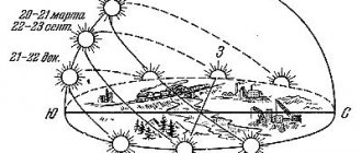
The goals of orientation are to determine your location as accurately as possible in relation to the sides of the horizon, noticeable local landmarks, maintain a given/selected direction of travel, and understand the position of local objects.
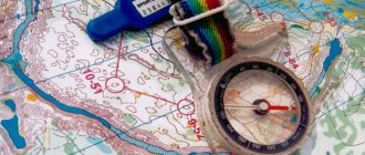
Orientation by compass
Few people know how to navigate without a compass. Therefore, when going on a hiking trip, especially for beginners, you should not ignore this device. Moreover, it takes up very little space.
To get your bearings, just set the compass to a horizontal position and release the needle brake. Then set it so that the zero division of the scale (C) is opposite the northern end of the arrow and coincides with the north of the map. Moreover, the center of the device should be level with the location indicated on the map. And this is what should happen in each direction of the horizon:
- C – 0 degrees;
- B – 90 degrees;
- Yu – 180 degrees;
- W – 270 degrees.
After determining the sides of the horizon, all that remains is to orient the map, marking on it your place of standing and local landmarks.
Orientation by compass without a map
For this, Adrianov’s compass is best suited, by which you can determine azimuths to surrounding objects and directions to them using the indicated magnetic azimuths.
Azimuth is the angle between the direction to the north and to some object (landmark). As a rule, it is measured in the direction of the apparent movement of the celestial sphere (clockwise on maps). By fixing the azimuth values, you can create a whole chain of landmarks. So, movement in azimuth is nothing more than determining the desired direction of movement and maintaining it during further movement.
To practice your ability to determine the cardinal directions without a map, you can take a compass when going into the forest for a “silent hunt.” It is best to choose a highway as a reference point. Having moved away from it into the forest in a perpendicular direction, but leaving the landmark in your field of vision, turn to face the road. Take out the compass and activate it. Turn until the pointer aligns with the zero scale.
Then, connect the center of the device and the road with an imaginary line. Record the direction of return. The front sight indicator will indicate the direction of further movement into the forest. When moving away from the road, you need to control the position of the arrow in order to notice in time a serious deviation from the given route.
If there is a need to return to the starting point, you need to take the compass so that the front sight pointer points forward. Then turn around with the device, wait until the north of the needle coincides with the north of the scale and move in this direction.
Tactical properties of the terrain.
Terrain properties that influence the organization and conduct of combat operations, the use of weapons and equipment in battle are called tactical properties. The main ones include terrain maneuverability, its protective properties, conditions for orientation, observation, camouflage and firing. In some areas, the conditions of the area's engineering equipment and water supply have a significant impact on the conduct of hostilities.
Terrain passability is a property of terrain that facilitates or impedes the movement of troops. It is determined primarily by the presence of paved roads. Thus, in forested-swampy, mountainous, desert areas, highways acquire the importance of the most important directions along which the main efforts of troops are concentrated.
Movement in combat is carried out where it is necessary according to the conditions of the situation and terrain conditions allow. Therefore, determining the possibility of movement of military and other equipment without roads is of particular importance. The passability of terrain without roads is greatly influenced by the nature of the relief, soil and vegetation, the presence of natural and artificial obstacles (swamps, rivers, lakes, etc.).
When assessing terrain maneuverability, the tactical and technical characteristics of combat and other equipment, the time of year and weather conditions are always taken into account.
Protective properties of the terrain - properties of the terrain that weaken the effect of the damaging factors of nuclear and other types of weapons and facilitate the organization of the protection of troops. They are determined by the nature of the relief, vegetation cover, and the presence of various natural and artificial shelters in the area. Deep and winding folds of relief, forests and other shelters significantly reduce the degree of damage from a nuclear explosion.
The protective properties of a terrain are most fully demonstrated if they are used in conjunction with other measures, such as dispersal of forces, their camouflage, and terrain engineering equipment. Skillful use of the protective properties of the terrain is one of the most important requirements for organizing modern combat.
Orientation conditions are terrain properties that help determine one’s location and the desired direction of movement relative to the sides of the horizon, surrounding terrain objects, as well as relative to the location of friendly and enemy troops. They are determined by the presence on the ground of characteristic relief elements and local objects that clearly stand out among other objects in their appearance or position and are convenient for use as landmarks.
The ability of each unit leader to quickly and accurately navigate the terrain contributes to the correct assignment of combat missions to units and fire weapons, accurate target designation and reliable control of units during combat.
Observation conditions are terrain properties that facilitate obtaining information about the enemy, his forces and means. They are determined by the degree of visibility of the surrounding area, viewing range and depend on the nature of the terrain, vegetation cover, settlements and other objects that obstruct the view of the area, as well as on meteorological conditions. The more ravines, gullies, heights, tree and shrub vegetation, and various types of buildings in the area, the less favorable the observation conditions.
The correct organization of observation and the results obtained help the commander to comprehensively assess the situation and make an informed decision.
Camouflage properties of the terrain - properties of the terrain that make it possible to hide the location and movement of troops from the enemy. They are determined by the presence of natural shelters formed by landforms, vegetation cover and human settlements. The most favorable conditions for camouflaging troops are created on rough terrain. Hollows, gullies, and ravines create good conditions for sheltering troops in concentration areas, and also serve as routes for covert maneuver and communication with the rear.
The camouflage properties of the area depend on the time of year, day and weather conditions. Thus, in summer, deciduous forests provide reliable camouflage of units not only from ground, but also from air surveillance. In winter, in such a forest, equipment is easily visible against the background of snow cover.
The camouflage properties of the terrain make it possible to hide objects both from the visual observation of the enemy and from his reconnaissance using various technical means, to ensure reliable secrecy of the disposition of troops, and to increase the surprise of striking the enemy.
Firing conditions are terrain properties that ensure the concealed placement of fire weapons, firing from guns and small arms at maximum ranges, as well as shooting adjustments. They depend mainly on the nature of the relief and vegetation cover.
When determining the conditions for firing, they establish areas of terrain in the location of the enemy and friendly troops that are not covered by small arms and PTS, and select advantageous positions for firing.
The conditions of the engineering equipment of the area depend on the type of soil, groundwater level, the availability of building materials, as well as the nature of natural and artificial shelters and obstacles. The condition of the soil largely determines the scope of work on preparing column tracks, digging trenches, trenches, and building shelters for personnel and equipment. The possibility of constructing various structures depends on the depth of groundwater. The presence of construction materials on the ground (timber, crushed stone, gravel, sand, etc.) largely determines the volume and timing of engineering work.
Ecology DIRECTORY
Taking into account the characteristics of the terrain during the construction and operation of transport structures is carried out by implementing the tasks of the functional-spatial organization of the human environment, transforming natural landscapes while preserving their originality; solving aesthetic issues. Quantitative criteria for assessing changes in landscape aesthetics in connection with transport activities have not yet been developed.[...]
Very difficult wind conditions at station. Bina is due to a combination of a number of terrain features, namely: the proximity of the main Caucasus ridge and the position of the station in the southern part of the Absheron Peninsula. Throughout the year, there is a predominance of winds from the north, north-west and south. [...]
Landscape architecture involves the implementation of construction in cities, taking into account the landscape features of the area, the design of gardens, parks, and recreational areas on the development territory.[...]
The profiles are laid in a rectangular strip 100–200 m wide, taking into account the soil and geomorphological features of the area, placing them from the watershed to the foot of the slope or river valley. In this case, all typical forms of relief receive a detailed description of the soil cover, revealing the topographical association of individual soil contours with certain forms of relief, which makes it possible to establish the patterns of formation of the soil cover of the study area as a whole. [...]
Other factors contributing to the occurrence of smog may be related to the climatic and orographic features of the area (the presence of mountain basins contributes to the stagnation of air masses, frequent occurrence of temperature inversions).[...]
Determining the leading aspects of the biology of populations, the spatial structure, in turn, is determined by the characteristics of the area (space) and the biology of a given species.[...]
The third group of factors characterizes the impact on workers of the climatic, geological and biological features of the area where work takes place. In real conditions, this complex set of factors that shape working conditions is united by diverse mutual connections. Everyday life has an impact through housing, clothing, food, water supply, the development of infrastructure in the service sector, the provision of recreation and the conditions for its implementation, etc. The socio-economic structure affects a person through the socio-legal status, material security, level of culture, education. Information impact is determined by the volume of information, its quality, and accessibility to perception.[...]
The main indicators are relief, hydrography, plant communities in combination with the lithogenic base.[...]
The value of the period of one-time excess of the calculated rain intensity p is selected taking into account the nature of the canalized object, topographical features of the area, basin area and the size of d.2i and for populated areas is accepted in accordance with the table. 10.2a.[...]
As already mentioned, the fresh waters of rivers and lakes, our main source of water supply, are different. This difference arose initially and is associated with the climatic zone and characteristics of the area in which the reservoir is located. Water is a universal solvent, which means that its mineral content depends on the soil and the underlying rocks. In addition, water is mobile, and therefore its composition is affected by precipitation, snowmelt, floods and tributaries flowing into a larger river or lake. Take, for example, the Neva, the main source of drinking water in St. Petersburg: it is mainly fed by Lake Ladoga, one of the freshest lakes in the world. Ladoga water contains few calcium and magnesium salts, which makes it very soft; it contains little aluminum, manganese and nickel, but quite a lot of nitrogen, oxygen, silicon, and phosphorus. Finally, the microbiological composition of water depends on aquatic flora and fauna, on forests and meadows on the banks of a reservoir, and on many other reasons, not excluding cosmic factors. Thus, the pathogenicity of microbes increases sharply during years of solar activity: previously almost harmless ones become dangerous, and dangerous ones become simply fatal.[...]
On the Absheron Peninsula, the number of days with strong wind reaches maximum values of about 100-140 days per year (Shubany, Puta, Bina and Sumgait), which is due to the specific features of the area.[...]
The period of a single overflow of the network for populated areas is taken depending on the nature of the sewered object (main streets, central squares), topographical features of the area, basin area and the magnitude of the runoff intensity according to the table. VI.1, and for industrial enterprises - according to table. VI.2.[...]
It is enough to indicate the search. The search for a place to strike was almost always associated with hunting. Wandering with a gun in search of animals and birds through the boundless taiga, the peasant carefully looked closely at the features of the area. The search for game was combined with the search for a cutting area.[...]
MICROCLIMATIC OBSERVATIONS. Meteorological observations at points not far from each other, at fairly short intervals (often at different heights above the ground) in order to identify the microclimatic features of the area. Observations are usually carried out over a short (not multi-year) period of time, and they must be compared with simultaneous observations of a permanent reference station in a given area. [...]
Hydrology studies the processes occurring in the hydrosphere, including oceans, seas, rivers, lakes, soil and groundwater, snow and glaciers, atmospheric moisture, as well as its relationship with the atmosphere, litho- and biosphere. Without the mutual influence of the atmosphere and hydrosphere, as well as terrain features, it is impossible to plan any economic and water management activities. [...]
Individual emission sources can be located very close to each other without their plumes adding up if air flows are only occasionally directed from one plant to another. The direction or trajectory of air flow in a given area depends mainly on the topography of the areas adjacent to the enterprise. Terrain features, such as location in a valley or similar orographic factors that direct the air flow, can be taken into account in advance as factors determining the configuration of the air flow path. The location of the sites on a gentle slope in relation to the smoke object is also important, since ventilating winds can direct emissions to objects that are especially sensitive to harmful substances contained in the emissions. Some insecticides are known to sensitize plants to the effects of smog, as found in the Los Angeles area. Emissions from an insecticide production plant can have a negative impact on crops if fields that rely on bee cross-pollination are located downwind. Enterprises producing 2-4 O experienced the same difficulty if broad-leaved plants grew downwind of the industrial site or the place where insecticide was sprayed. [...]
Types of natural lighting: side (through windows), overhead (through lanterns) and combined (through windows and lanterns). The use of a particular lighting system depends on the purpose and size of the room, its location in the building plan, as well as on the climatic features of the area.[...]
The second group of engineering protection means, along with the named road elements, contains several settling pools that make it possible to control the accidental release of hazardous and toxic pollution ingredients, of three types, each of which is used taking into account the characteristics of the area. [...]
Cross-sections, points, reference sites, transect sites for permanent observations and research are placed on the drainage area, taking into account its landscape structure, the structure of the hydrographic network, the location of biotopes of various types, geological, hydrogeological and geochemical features of the area, and the location of pollution sources. An assessment of the state of a particular component of the natural environment is given on the basis of a comparison of normative and actually observed values of indicator indicators, comparison with the characteristics of analogue objects and/or background territories. Integration of private assessments is carried out on the basis of expert assessments.[...]
Wagner's method made it possible to solve some issues, such as spruce regeneration, but in many respects it did not live up to the initial calculations. Thus, according to the description of German foresters who got acquainted with the results of cuttings by H. Wagner, “the forest landscapes in Gaildorf make a sad impression: under the ruler and with a compass, the borders drawn stretch across the hills and valleys like a frozen mockery of the principle of spatial order, which must first of all take into account relief; intertwined curtains of mature forest show the negative aspects of fragmentation of plantings, and young growth with a lack of beech and fir is unlikely to reach the level of mother plantings in terms of structure and productivity"!.[...]
The monitoring network includes a set of control points, sections, profiles, wells, and sites located in the zone of influence of the reservoir and outside it. The placement of the network in the catchment area is carried out taking into account the landscape structure, hydrography, the location of biotopes of various types, as well as the geological, hydrogeological and geochemical features of the area and the location of pollution sources. The network of permanent observation points should cover the zone of influence of the reservoir in the upper and lower reaches. It is used to determine deviations of observed characteristics from standard or predicted levels and timely identification of unpredictable phenomena and processes. [...]
When creating underground storage facilities in rock salt deposits, there is a need to utilize and discharge a large amount of saturated rock salt solution formed during the leaching process of the chambers. In order to protect the environment, in order to avoid contamination of water supplies, it is not allowed to discharge brine into fresh water bodies and underground moisture-absorbing collectors. Depending on the terrain and operating conditions, to prevent leaks of sodium chloride brines, protective impervious screens made of clay soils, non-shrinkable polymer cement concrete, as well as screens made of polyethylene film, synthetic rubber and various sealants are used.[...]
In Finland, the “Scandinavian” (the equally “Morozov” method - according to G.F. Morozov, or the method of German-Russian foresters) method of cutting down forests in several stages is used: first they are thinned out by sanitary selective felling with an increase in growth. The logging residues remain in place and serve as mulch: This allows you to preserve the forest environment and type of vegetation. But at the same time, there is a rather strong impact on the climatic features of the area - park forests are much drier than closed forests. [...]
It should be especially noted that lead and lead-containing aerosols are characterized by high toxicity, the ability to penetrate the body and accumulate in it, as well as increasing exposure to humans as a result of pollution of the atmospheric air and the biosphere as a whole. Information available in the scientific literature shows that a gradual increase in the concentration of lead in human tissues occurs due to widespread pollution of the biosphere, which is explained not only by the natural features of the area, but also by the degree of its man-made pollution (usually unpolluted atmospheric air contains up to 0.001 μg/m3 of lead). [...]
The dispersion of emissions entering the atmosphere is determined by its circulation. The nature of the movement of air masses depends on their temperature field (temperature distribution along the Earth's surface and normal to it), pressure distribution and densities of atmospheric fronts. Therefore, in addition to large-scale air currents that move emissions over hundreds and thousands of kilometers, numerous local circulations arise in the lower layers of the atmosphere. These circulations are associated not only with the state of the atmosphere, but also with the geographical, geological and other features of the area where the sources of pollution emissions into the atmosphere are located. In large industrial cities and in the territories adjacent to them, air pollution is often tens to hundreds of times higher in the ground layer than in the upper layers of the atmosphere. Since, with a stable direction of winds, emissions of various pollutants into the atmosphere from a number of sources of their formation are combined on the leeward side into a common plume, then in it, firstly, the characteristics of individual sources are smoothed out, and secondly, secondary products of pollution transformation are formed. Therefore, during large-scale dispersion of emissions from anthropogenic sources, both primary and secondary pollution are found in the atmosphere.[...]
It is known (24) that control over the concentration of pollutants in the air is carried out at stationary, route (mobile) and flare posts. Stationary and route posts are designed to detect long-term changes in the content of pollutants at fixed points. Determining the location of such posts largely depends on the results of preliminary comprehensive survey of the state of air pollution from industrial and transport emissions, household and other sources. During the survey, the physical and geographical features of the area, meteorological conditions, location of pollution sources!, a list of polluting components, etc. are studied. An important addition to this information is data on the amount of emissions per at different distances from sources, which are installed using torch posts.[...]
As already indicated, the process of air pollution goes through four stages: the formation of harmful substances, their release, distribution and impact on objects. Land allocation through zoning may be useful at any of these stages. The location of emission sources, determination of emission masses and the nature of the use of surrounding land plots, taking into account the harmfulness of pollution, themselves form the basis of planning and zoning. Zoning itself, as a measure against air pollution, is based mainly on data on the processes occurring in the atmosphere, which is the medium for the spread of pollution. To develop a comprehensive regional land use plan, it is necessary to deeply study the demographic, topographic and climatic features of a given area. These three factors are listed in descending order in terms of a person's ability to influence them. Climatic features are generally beyond human control, but their correlation with atmospheric pollution must be taken into account. Small changes in topographical features are currently within human capabilities, but changes on a regional basis that could cause changes in climatic conditions are not yet practically feasible. Demogra; ■physical factors completely dependent on the nature of use or ownership of a given territory are studied.[...]
A typical example of the use of clayey OBR as a structure-forming agent can be the results of experiments given in [67], (174, [180], [182], [200]. Analysis of the mechanical composition of soils, their water-physical and agrochemical properties indicates a significant improvement in agronomic the value of such soils after adding OBR in amounts up to 15%. The achieved effect is ensured by the fact that the clay colloidal fraction of OEZR promotes the agglomeration of sandy and sandy loam fractions of the soil and the cementation of its mechanical elements. Moreover, such soils, along with the improvement of their water-physical and agrochemical properties, less susceptible to wind and water erosion. The latter circumstance for many areas in which sandy and sandy loam soil types are common seems no less important than agronomic value, since it significantly reduces the risk of degradation of landscape features of the area and soil-vegetation cover.[...]
Orientation using two selected objects

First you need to find and select any two objects relative to which you will orient yourself on the spot. It is important that both of them are located at a small distance from each other, in a common visibility area.
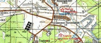
Then go to one of the landmarks and find it on the topographic map.
Look at another landmark and turn the diagram towards you so that the direction vector to the second object on the map coincides with the same direction vector on the ground.